Monday, 27 July 2015

Peterhead and Port Edgar

On Friday the strong winds had died down and, with a Westerly force 3 and bright sunshine we filled with diesel and left Whitehills bound for Peterhead. For a couple of hours we sailed with full sail, the genoa boomed out opposite the mainsail, dipping into the bays along the coast to keep out of the west going tide, sometimes picking up a back eddy pushing us along.

Off Troup Head we at last managed to photograph gannets taking off and in flight. The cliffs were thick with seabirds with more on the water, a fantastic sight.

Yes, all those white dots are seabirds!
Gannet in take off mode.

Approaching Fraserburgh the wind dropped enough for us to need the engine on then, as we turned South, sprang up again from the East allowing us to sail for a while. As we approached Rattray Head the wind veered to the South with ominous rain clouds building up so the engine went back on and we motored for the next hour and a half to Peterhead.

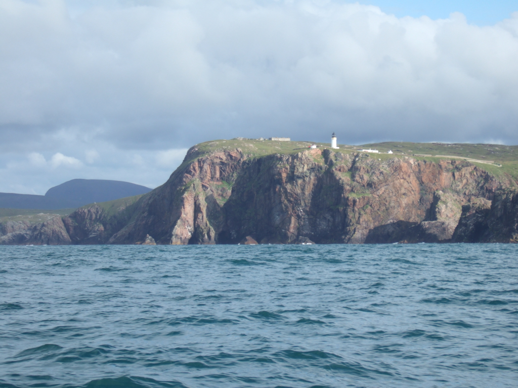
Rattray Head lighthouse

Peterhead harbour is a busy port and was full of offshore supply ships. We reported in for permission to enter and headed into the marina, tucked away in the South West corner. Our stay in Peterhead was only short as we needed an early start next morning for the 120 mile leg to Port Edgar, located between the new (under construction) and old Forth road bridges. We were lucky enough to see an air display over the harbour, celebrating the end of Peterhead Scottish week, set up to promote trade and tourism. Apparently Peterhead is the only Scottish town to do this.

Offshore supply ships in Peterhead harbour.
Peterhead marina and some evening sunshine.
The air display over the harbour.

To make the most of the South going tide would have meant an early, circa 0500, start but would have meant that we got to Port Edgar in the dark so we opted for a slightly later 0700 start, eventually getting away at 0720 with an eta Port Edgar 0430 the following day. Outside the harbour we were greeted by a NNE 14 knot breeze so the engine quickly went off and the spinnaker went up. We needed to maintain this course for the next 78 miles! As with a number of our passages this was not to be. After nearly 3 hours we were off Aberdeen and the wind dropped, forcing us to drop the spinnaker and go for the engine again.

Distant view of Aberdeen, can't quite make out Robyn's flat!

For the rest of the trip the wind remained light and what there was came from the SW! The only plus being that the autopilot could do all the steering. With a route set on the plotter we didn't need to touch the helm until we were approaching the Forth Rail bridge! Eventually rain set in so we put the sprayhood up to give whoever was on watch somewhere to lurk but still see what was going on. We experimented with collecting rainwater off the end of the boom and easily collected a couple of litres in a matter of minutes. We won't run short of water as long as we remain in Scottish waters! We were in the outer Forth by the time it got dark, plenty of lights to check on our position but also a few ships to keep an eye on. I had one panic when the AIS said that the CPA (closest point of approach) of a pilot boat was 10 feet! Fortunately the pilot was heading for a cruise ship in front of us and stopped before getting anywhere near us! By 0530 we passed under the iconic railway bridge and found ourselves an empty berth tucked well into the marina (the outer berths are subject to swell and wash from passing ships) and put our heads down for a few hours kip.

Rainwater collection.
Evening clouds off St. Andrews.

We had 2 reasons for visiting Port Edgar. One was to meet up with daughter Robyn, who had been in the South all week, and could use Port Edgar as a stop off point on her way home. Due to traffic she was quite late getting to us but it was still nice to have an hour with her before she had to be on her way again.

Port Edgar marina, sandwiched between the new and old road bridges.
The iconic Forth rail bridge, celebrating 125 years old.

The second reason was to meet our old friends Kay and Jock Blair, who used to own and run The Bosun's Locker chandlery in the marina and also built the hull of our E Boat, our first foray into keelboats in 1980. Jock and Debbie first met in 1973 sailing Fireballs at Stonehaven. Kay and Jock came aboard for tea on Monday morning and invited us to dinner and a bed in a house, luxury and not to be turned down lightly! So a pleasant evening was passed reminiscing and sharing stories over a couple of bottles of wine finishing with a glass or two of malt.

Jock returned us, slightly jaded, to the boat on Tuesday morning. We are now on passage to Eyemouth, 50 miles away and our last port in Scotland. No wind so the engine is working for its living again.


Thursday, 23 July 2015

The land of helpful harbourmasters

We planned to leave Wick on Tuesday morning, heading for Lossiemouth, leaving the first of our helpful harbourmasters. John, the assistant harbourmaster, met us at the pier head on the way in to give us directions to the inner harbour, then jumped in his car and was waiting to take our lines when we came on to the pontoon. He then took Debbie to the local shop to stock up with milk and bread and advised us on good places to see and eat in Wick, excellent service! While in Wick we found a good butcher, Sinclairs in MacArthur Street close to the harbour, we stocked up with vacuum packed meat.

We duly left Wick on Tuesday, expecting a Westerly wind. What we got was a South Westerly and the remains of the seas from the strong winds of the previous day. We were not making the course for Lossiemouth, struggled to maintain enough speed in the confused sea to get there in time for sufficient water in the entrance and the motion was horrible and made steering difficult and tiring. After about 8 miles we had had enough and turned around to head back to Wick and the berth we had vacated in the morning. As a reward for making a good call and turning back the Admiral allowed me to buy a bottle of the local Old Pulteney malt for the ships stores!

The weather forecast was better for Wednesday and we plotted alternative courses for Lossiemouth, Buckie and Whitehills, depending on the wind direction. We soon firmed up on Whitehills and had a good breeze from SSW allowing us to have full sail up.

East of the Jacky and Beatrice oil fields the wind became more variable, sometimes dropping light, sometimes heading us a long way off our direct course so we completed the second half of the passage with a mixture of sailing and motor sailing, with the last 2 or 3 miles into Whitehills under engine alone.
Multi rainbows approaching Whitehills.

On to our second helpful harbourmaster. We made contact with Bertie Milne, Whitehills harbourmaster, a little way out to check that he had berthing space for us. When we approached the harbour entrance he was there with directions and his camera "because you can't easily take pictures of your own boat". He was then at the pontoon to take our lines and, because it was getting late and was raining he took Debbie to the local fish and chip shop so we didn't have to cook on board! He left us his camera SD card so we could download the pictures, some of which are in this blog.
Approaching the pier head with rain clouds behind us courtesy of Bertie Milne.
The narrow entrance channel courtesy of Bertie Milne
The tight turn into the outer basin courtesy of Bertie Milne.
Approaching the berth courtesy of Bertie Milne.

Whitehills is a small, ex fishing harbour, with a narrow entrance channel and tight turns into the inner and outer basins. The inner basin has pontoon berths which were full of local boats who must get very good at boat handling in the confined spaces between the berths. The marina has good shower and washing facilities and a good laundry and crew room with microwave and kettle and comfortable chairs if you want to get away from the boat for a while! The harbour is owned and managed by the local community through elected commissioners and the whole place is very clean and tidy, as is the rest of the village.
Tight manoeuvring spaces in the inner basin!

As it has been blowing hard all day today we have caught up with the laundry and Bertie gave us a map of a coastal walk for this afternoon, which was very nice. The weather looks better tomorrow so we'll top up with diesel in the morning and see if we can get to Peterhead and then prepare ourselves for some longer 'hops' Southwards down the East coast.
Whitehills from the coastal path.

Monday, 20 July 2015

Pentland Firth and back to the mainland

As indicated at the end of the last blog, we sailed on Thursday afternoon for Widewall Bay on South Ronaldsay. With a strong South Easterly breeze we had a good, if chilly, sail hard on the wind with 2 reefs in the main and a partially furled genoa. John helmed the whole way, getting used to a wheel rather than a tiller. He had a smile on his face so I guess he enjoyed it. We pretty much had Scapa Flow to ourselves.

Leaving Stromness harbour
John and Debbie getting the best out of Lacerta.
WW2 fortifications on South Ronaldsay.

Reeds says that Widewall Bay anchorage is sheltered except for in South Westerlies. We found it very open with the low lying surrounding ground offering little protection from the SE wind, which was forecast to get stronger. After a brief stop for a cup of tea we opted for a little more sailing and headed off under genoa only, downwind to an anchorage between Hoy and a small island called Rysa Little, eventually anchoring in the lee of Rysa Little at 2145. The anchor dug in pretty well immediately and with plenty of chain out we felt much more comfortable and settled down to a late dinner of pasty and beans and a wee dram for a nightcap.


The wind blew hard from the SE throughout the night and all of Friday with plenty of rain so the day was spent reading, drinking tea and playing word games. As John was an ardent Scrabble player the Phillips family were beaten hands down and learnt a few new words, some slightly risqué! The wind died down during Friday night and gave us a very quiet night but swung around to the West putting us on a lee shore, not too much of a problem during the night when the wind was light and during the morning when the tide was rising but by the afternoon the wind was blowing strongly from the West and the tide was falling. We opted to up anchor and, with just a scrap of headsail unrolled, sailed to Long Hope, a deep inlet at the South end of Hoy where the village of South Ness has visitor moorings just off the ferry pier. After a short 1 hour sail we were snug on a substantial mooring.


The weather looked to have a window on Sunday which would be good for crossing the Pentland Firth. John and I checked and rechecked the tide tables and decided we should go while the last of the West going tide was still running so we weren't caught in the East going stream and carried out towards Muckle Skerry. We left at 0700 on Sunday morning and everything worked to plan except the forecast NW force 4 didn't materialise and we had to motor. The crossing was much calmer than we anticipated and we had a fair tide South from Duncansby Head. We debated whether to stop in Wick or carry on another 40 odd miles to Lossiemouth, eventually deciding on Wick as it was touch and go whether we would get into Lossiemouth on a falling tide in time for enough water in the entrance. Wick turned out to be a good call as we were in by midday and the afternoon turned out to be very wet.

Duncansby Head
Doing the sums. Will it be Wick or Lossiemouth?

John was leaving us in the morning so we walked in the rain to find the railway station. John had read the Yachting Monthly article (May 2015) "19 tips for the perfect crew", number 19 of which was take the grateful skipper out to dinner. He didn't have to do that as he ticked most of the other 18 boxes but we did enjoy an excellent dinner at Mackays Hotel.


We saw John off at the station at 0730 this morning and spent the rest of the morning shopping to restock the boat and giving her an airing while it wasn't raining. As it has been blowing hard from the East all day we spent the afternoon at the excellent Wick Heritage Museum, a real treasure trove of life in Wick from the heyday of the hearing fishing fleets, obviously a good call as the lifeboat has just launched!

Tucked up in the marina while the seas raged outside


Thursday, 16 July 2015

Cape Wrath and the Orkneys

Ullapool returned to its more peaceful state after the skiff racing finished and we spent Sunday doing mundane stuff like shopping. Evening drinks on board with Isobel and David off Glance, a 120 year old cutter from Strangford Lough finished off the day nicely. On Monday morning we went alongside the quay to top up with water and await the bus delivering our third crew member for the trip over the top. John Thorn, from Torquay, fresh from Royal Torbay Yacht Club offshore week duly arrived after an epic journey of missed flight, train to London, sleeper train to Inverness and bus to Ullapool. We were only half an hour late leaving Ullapool, not bad!

Alongside for water and awaiting John.
Our destination from Ullapool was Kinlochbervie, a sheltered fishing port 47 miles North and only 14.5 miles from Cape Wrath. The trip introduced John to the grey Scottish mist and drizzle, a far cry from the sunshine and warmth of the Channel Islands! At least there was a little breeze allowing us to sail as soon as we were out of Loch Broom and even set the spinnaker for a while until the wind started to fail in the evening, needing the engine for our approach to Loch Inchard and Kinlochbervie. We had a few slightly anxious moments trying to identify the entrance to Loch Inchard. The beacon shown on the chart to the North of the entrance is actually quite small and not easy to see until you are quite close in. Nevertheless we were in, tied up and enjoying a venison casserole by 20.15.
Berthed at Kilochbervie.
Kinlochbervie has obviously been a successful, busy, fishing port. There are packing sheds and infrastructure to deal with a large number of trawlers but one thing that was absent during our visit was fishing boats! Rachael at the harbour office said that at busy times the port supported over 40 trawlers, now reduced to 7 or 8, only a couple of which were deep sea boats, but they did still land white fish rather than the crabs, lobsters and prawns which Stornoway had reverted to.
The empty fishing port.
We planned for a late afternoon start on Tuesday, giving us a fair tide around Cape Wrath and into Hoy Sound on Orkney on Wednesday morning. The weather improved enough for a walk from Kinlochbervie before we left and rewarded us with our first sighting of an eagle, circling the hill tops and flying off into the distance before we could get the cameras out.
We left Kinlochbervie at 15.40 on Tuesday afternoon in bright sunshine but only light winds. We attempted to sail when we were outside the loch but the wind was too light to maintain our boat speed so we motor sailed Northwards. The weather did reward us with bright sunshine for rounding Cape Wrath. The last Cape we rounded was Cape Cornwall, at the other end of the country and a major milestone achieved and duly recorded on photograph!
Cape Wrath
We were there!
And so was John!
After rounding the Cape the sea flattened off and we settled into our watch routine for the 50 mile leg overnight to Stromness. Having a third crew member on board allowed us the luxury of 2 hours on, 4 hours off. There was enough wind for an hours sailing in the night otherwise we motored the whole way. It never got fully dark so we could see Hoy from a long way off and entered Hoy Sound at 0500, berthing in Stromness Marina at 0535.
After a couple of hours sleep and a late breakfast we tried and failed to hire a car to explore the islands. The Orkneys were obviously busy! John found a bus tour which visited some of the major historical sites which proved to be better than a car hire. An open top bus (bit chilly but when the sun shines shame not to enjoy it) took us to Scara Brae, a Stone Age village, dating from 3100BC, which had been exposed in 1850 by a storm washing away the sand. Careful excavation has revealed a sophisticated civilisation. Amazing to see domestic life from all that long ago.
Scara Brae
Stone Age living.
Adjacent the site is Skaill House, a splendid Manor House first built in 1620 for Bishop George Graham and much extended over the years and restored and opened to the public in 1997.
The tour continued with a visit to the Ring of Brodgar, a Stonehenge like circle of sandstones, passing another archeological dig at the Ness of Brodgar. The Orkneys obviously had a thriving Stone Age population!
A couple of old relics and some stones!
The bus tour finished in Kirkwall. We had a brief walk and coffee stop before catching the normal bus service back to Stromness. In amongst the yachts in the marina is a fleet of Orkney Yoles, beamy open fishing boats now raced from Stromness as well as fished from with an active association.
Orkney Yole.
We have a forecast gale to sit out tomorrow and are intending to sail to Widewall Bay on South Ronaldsay to sit out Friday before crossing Pentland Firth on Saturday, heading for Wick.


Saturday, 11 July 2015

Stornoway in the rain and recrossing the Minch

Hiring a car on Tuesday in Stornoway proved to be the best way of making something of the truly awful weather. Rain varied from heavy to continuous drizzle with strong winds and poor visibility, at least we could view it from the relative comfort of a Fiat Panda with a good heater!

We started the day heading out to the Eye Peninsula to the East of Stornoway and were surprised at how much housing we passed. On a good day the views from the lighthouse at Tiumpan Head would have been good but in the mist there wasn't much point in hanging around. Retracing our steps to Stornoway we headed North, first up the East coast then across the moorland to the West coast with a view to heading up to the Butt of Lewis in the North of the island. The Northern part of Lewis is relatively low with extensive moorland. With poor visibility and not very exciting scenery close to we decided this would be a bit pointless and did an about turn, heading South down the West coast to some more rugged and interesting scenery.

We made a stop at Dun Carloway Broch, a circular tapering building built of dry stones in about 50BC as a dwelling. The circular outer wall had two skins, like a modern cavity wall but with a much wider gap tied together with flat stones which also formed staircases between the floors. The entrance openings were narrow and low, on the basis that it is very difficult for an enemy to attack when having to bend down to get in! We got very wet walking up to the Broch so dried out over a sandwich lunch in the car with the heater on full blast! Sue in the visitor centre was most knowledgeable about the Broch and it is testament to the strength of the building that it has survived nearly 2,000 years of Hebridean storms.

In between the walls of the Broch.
Try fighting your way in when you have to approach like this!

We stopped at the visitor centre at Callanish Standing Stones, a Hebridean version of Stonehenge, but opted not to repeat the soaking we had at the Broch and made do with tea and cake instead! One of the brochures left in the hire car talked about a distillery at Uig, a village out towards the West of the island. We failed to find the distillery but the drive through rugged scenery on roads that were single track with passing places for a good part of the way was worth doing. A number of lochs extend a long way inland on this part of the island with fine sandy beaches, all viewed from inside the car in the dry. The campers by the side of some of them did not appear to be having much fun! We had planned to visit the eagle observatory in the South of the island but decided that the likelihood of seeing anything was remote so we made our way back to Stornoway, finishing the day with some excellent haddock and chips from Cameron's chip shop and a film on the boat. Colin, the owner of Cameron's, had been in the trade for many years and certainly knew his business. He lamented the fact that he had to get his fish from the East coast, the fishing boats in Stornoway landing mainly crabs, prawns and lobsters.

Wednesday was forecast to be better weather so we aimed to recross the Minch to visit Badachro in Gairloch. We arranged to go alongside the quay to top up with diesel next to 'Leader', a Brixham trawler built in 1892. We discovered that she was skippered by Ben Wheatley, who we knew from our voyages on the tall ship Stavros S Niarchos when Ben was bosun. Ben now works for The Trinity Sailing Foundation based in Brixham and lives in Stoke Gabriel. We went alongside Leader after refuelling and exchanged details so we could meet up with Ben when we return home. Leader was on her way to Norway in a tall ships race but retired on Tuesday due to the bad weather that forced us into a hire car.

Alongside 'Leader'.

The wind was from the N and NW for our return trip, and a good force 5. We started with just a double reefed mainsail then added a partially furled genoa, boomed out on the other side. With a moderate sea the waves made steering hard work but rewarding, regularly making over 8 knots. Even though the sun was out it was still cold enough for thermals and full waterproofs! We made the 42 mile trip in 6 hours, 7 knots average and anchored in Badachro harbour at 19.30. A pretty place with a reputedly good pub but as we didn't go ashore we didn't sample it.

A quick, but roly trip across the Minch.

We had a couple of days spare before we needed to be in Ullapool and realised that we were close to Acairseid Mor on Rona, one of the top favourite places on Hugh and Nicola's 50 favourite places list so that became our Thursday destination. Only 20 miles away we could get there in the early afternoon and get ashore for a walk and meet the warden, Bill Cowie. The sail started well with full sail and a beat into a westerly breeze out of Gairloch. Outside the loch the breeze gradually faded until we eventually had to go for the engine again.

Acairseid Mor is another natural harbour with a rock strewn entrance and careful pilotage needed to get in. Once in we anchored a 100 metres or so off the jetty in perfect peace, blew the dinghy up and rowed ashore to be met by Bill on the jetty who told us where to walk and to call in at Rona Lodge, his cottage, on the way back to the boat. Bill and his wife are the only permanent residents on Rona and sell postcards with Rona stamps and frozen seafood and Rona venison to help support the management of the island. After the walk Debbie bought postcards and we stocked up with venison burgers and vacuum packed steaks. For once the weather was kind for our walk and the 360 degree view from the high point was spectacular.

Acairseid Mor anchorage.
Rona Lodge.

Rain returned in the evening and continued into Friday, when we set sail Northwards for the Summer Isles, aiming for the 'Cabbage Patch' harbour on Tanera Mor, visited by Libby Purves and family during their trip, recorded in 'One Summers Grace'. The sail was quick, the wind now being in the Southwest, and would have gone down as one of our best if the weather hadn't been miserable, rain and drizzle and poor visibility so all we could see of the coastline was faint grey outlines in the mist. Thank goodness for a good chartplotter!

The Cabbage Patch, Tanera Mor.

We anchored in the Cabbage Patch in the early evening and had a meal of Rona venison burgers, which were great, moist and full of flavour without being greasy. We need to go back for more! In the morning Debbie would have liked to have had the time to go ashore and see if the families which befriended the Heiney/Purves family were still there but we needed to make the short trip to Ullapool in time for some shopping and to get some laundry done so we were off by mid morning and moored in Ullapool in time for lunch.

The Harbour Trust staff at Ullapool were most helpful. Debbie had arranged for a box of Aloe Vera products to be delivered to Ullapool for us. We couldn't go alongside the pontoon to collect it as the place was really busy due to a skiff rowing event taking place so they brought the box out to us on the mooring and took Debbie ashore to visit the laundry.

The skiff racing was a big event. We watched the last race of the day, which was a ladies race starting off the ferry pier to a turning line across the loch and back. The boats looked hard work to row and the winning girls certainly deserved the cheers as they crossed the finish line.

Just after the start.
Still going strong at the finish.


Monday, 6 July 2015

The Outer Hebrides

Saturdays sail across the Little Minch to Harris in the Outer Hebrides proved to be very frustrating. We stayed in Loch Snizort for most of the morning, waiting for the strong Easterly winds to veer to the South and ease off and the rain squalls to die down. We eventually left just after midday, running down the Loch at 7 knots with just the partially furled genoa, which would have made a very quick passage across to Scalpay, a small island at the South end of Harris. As we left the shelter of the loch and headed out into the Minch the wind did start to ease. With the forecast force 3 or 4 we expected to be able to hoist the mainsail and set the genoa on the spinnaker pole on the opposite side ( goose winging) and still have a fast passage. As we hoisted the mainsail the wind dropped still further and with the swell there wasn't enough to keep the sails full so we had to revert to the engine. The monotony of the trip was relieved a little by spotting wildlife, the list of sightings included a curious seal, a pod of dolphins, guillemots, Debbie's favourite puffins, gannets, very elegant in flight, razor bills, oyster catchers, arctic skuas and terns, we are trying to identify the different species of tern but for now they all have to be just terns!

Approaching the road bridge to Scalpay

With about 4 miles to go the wind decided to pick up again so we were able to get some decent sailing for the last 3/4 of an hour until we got to the bridge connecting Scalpay to the rest of Harris. Even though I had checked the clearance (20 metres against our 15.8 metre air draft), Debbie still cringed as we passed under!

Room to spare?

A short distance further on, after negotiating a few rocks we entered the North Harbour of Scalpay, a small, almost totally landlocked natural harbour on the West side of the island. With 3 yachts already anchored it seemed positively crowded, we had to motor around for a while to find enough depth, clear of the other yachts, for us to anchor. Even then we had to make do with a 1/2 metre margin at low water rather than the 1 metre minimum below the keel that I prefer. For such a small island the construction of a road bridge seemed to be a very expensive undertaking. There must be a profitable fishing and processing industry to justify it, certainly the pier in the North Harbour was crowded with fishing boats.

We originally planned to go ashore on Sunday morning but with strong spring tides in the Sound of Shiant to the North of us we decided to move on in the morning and make use of as much favourable tide as possible, no wind again so the engine was called into use again. We planned a fairly short trip to Loch Mariveg, 20 miles further North. Loch Mariveg is another small natural harbour, protected by a number of small rocks and islets so it is almost perfectly sheltered from all wind directions. The entrance channels are narrow but deep with rocks rising either side of us as we made our way in.

20 degrees and bright sunshine, the Admiral is thinking about taking her hat off!
The entrance channel to Mariveg.

It had rained for most of the trip, with the Admiral on watch in the rain but the sun came out as we made our way into the loch and anchored close to the shore in the SE corner as the pilot book suggests. Stunning is the only word to describe the place. We could have chosen one of about half a dozen protected anchorages on the way in with only seals for company. Although the village of Marvig, scattered houses around the loch, appeared remote, it seemed to be successful. On our walk ashore we met a young couple with their young son and new baby daughter who had just built a stunning house facing the water with a large boat shed and slipway close by to run a boat building and repair business. Their children would go to the local school 4 miles away, there would be about 6 of the same age in a class, very different to when ours went to school, and what a place to be able to grow up and play.

Loch Mariveg anchorage.
View across the loch.
Sunset over Mariveg.

Yet again the weather was set to deteriorate so we planned an even shorter trip on Monday, 8 miles to Stornoway, where we could stay for a couple of nights while the bad weather went through and stock up with provisions and fill the diesel and water tanks and the gas bottles. As we head around Cape Wrath towards the Orkneys there are limited places where we can do this and lie alongside a pontoon.

The trip turned out to be an excellent, if short, sail. Bright sunshine and a pleasant following breeze. No engine required today! We were tied up to a pontoon in Stornoway's very sheltered marina before lunch and have booked a hire car for tomorrow to see a bit more of the rest of the island.

Moored in Stornoway marina.